")
")
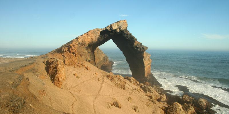
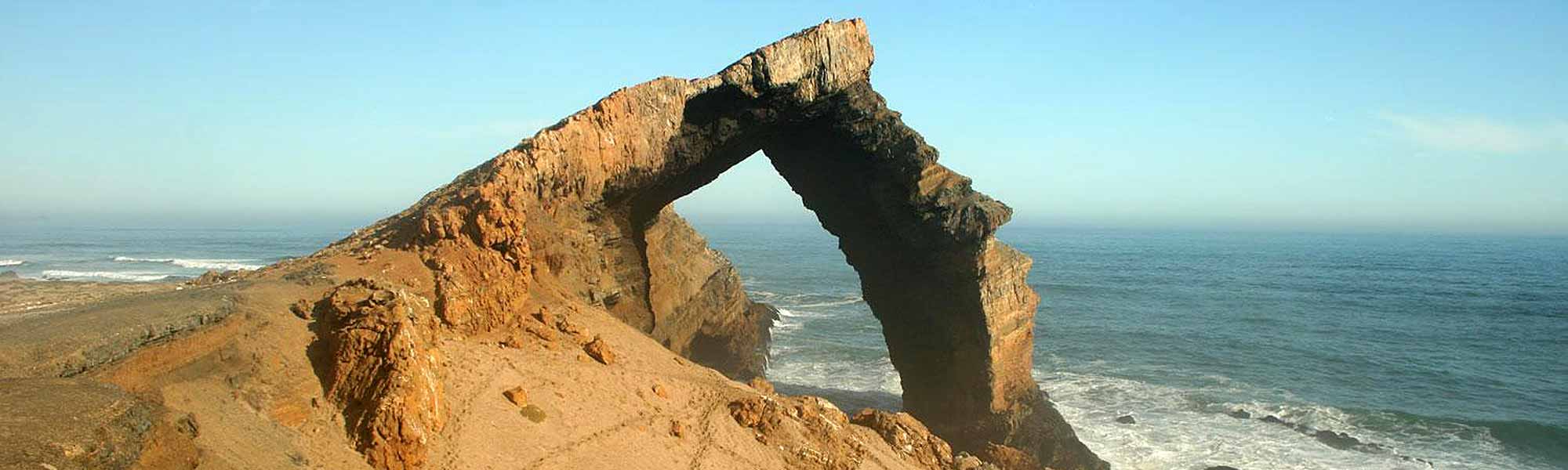
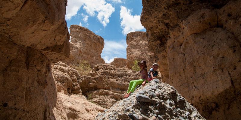
Bogenfels Arch
Lime rock bridge south of Lüderitz
The Bogenfels rock arch is a 55 m high lime rock formed like a bridge. It is situated at the south Atlantic coast in the middle of the Restricted Diamond Area about 100 km south of Lüderitz.

Here we provide an overview of the most popular landmarks and points of interest in Namibia. Please notice that National Parks, private conservation areas and many other destinations are presented in other lists.
The Bogenfels rock arch is a 55 m high lime rock formed like a bridge. It is situated at the south Atlantic coast in the middle of the Restricted Diamond Area about 100 km south of Lüderitz.
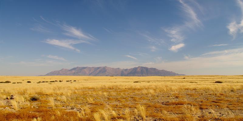
The Brandberg Mountain Range– or just the Brandberg – is situated in the Erongo region in the west of Namibia about 90 km from the Atlantic Ocean and covers an area 760 km². The mountain range has a mean height of 2500 metres and impressively surmounts its surrounding by some 2000 meters.
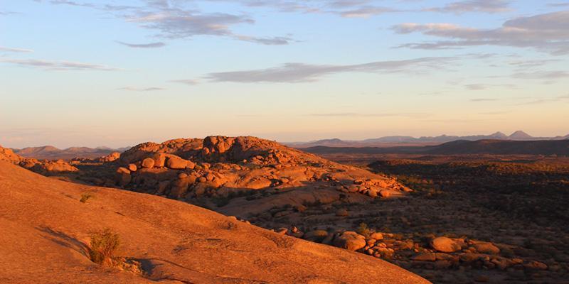
Many photos depict the enormously impressing granite rock formations of Namibia. Especially in the Erongo Mountains, the ancient remains of a volcano, between Omaruru and Usakos one can find a large variety of these surreal appearing formations. Most famous is the Bull’s Party on farm Ameib.
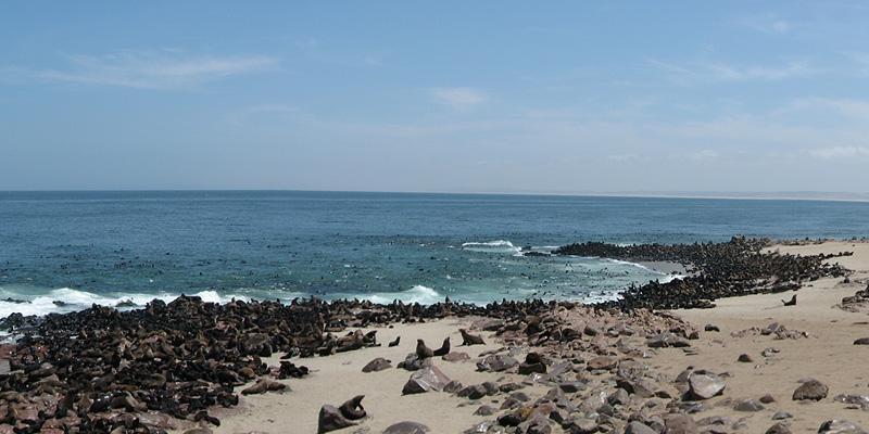
Cape Cross offers two highlights: Firstly a historical landmark where Diego Cão set foot on land in 1485 as the first european. Secondly a very large cape fur colony including deafening shouts und heavy smells.
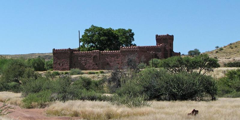
Many tourists will rub their eyes: like a mirage a castle made from red sandstone emerges from the surrounding desert. Defence tower and battlements and the impression of a middle age castle have been least expected.
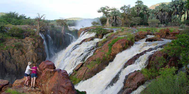
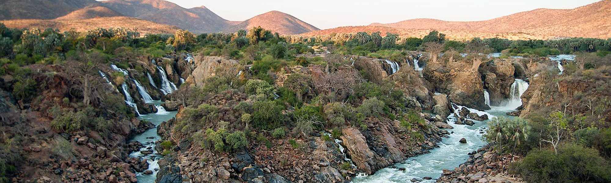
The border river between Namibia and Angola, the Kunene, plummets down a 40 metre deep gorge at the Epupa Falls close to the nearby village of Epupa. In the Herero language Epupa means “falling water”.
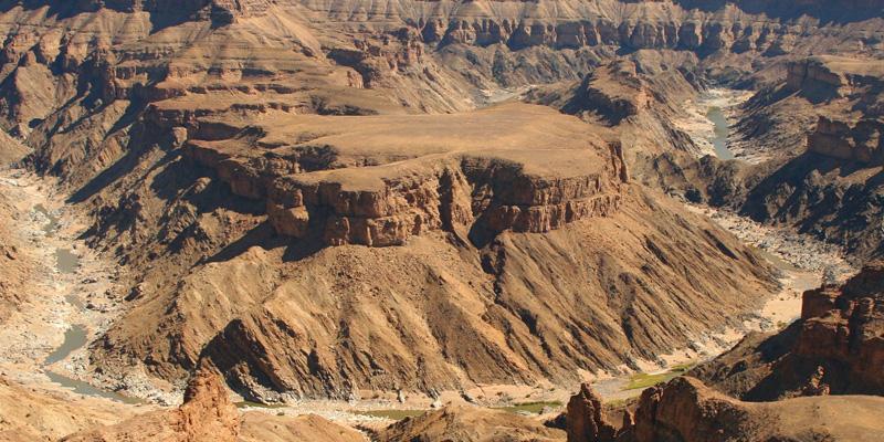
The Fish River Canyon is the second largest canyon worldwide after the Grand Canyon in the USA . The Canyon forms part of the state-run Ais-Ais Richtersveld Transfontier Park. Entrance to the Park is situated 10 kilometres from the well-known view point Hell`s Bend at the Hobas Restcamp.
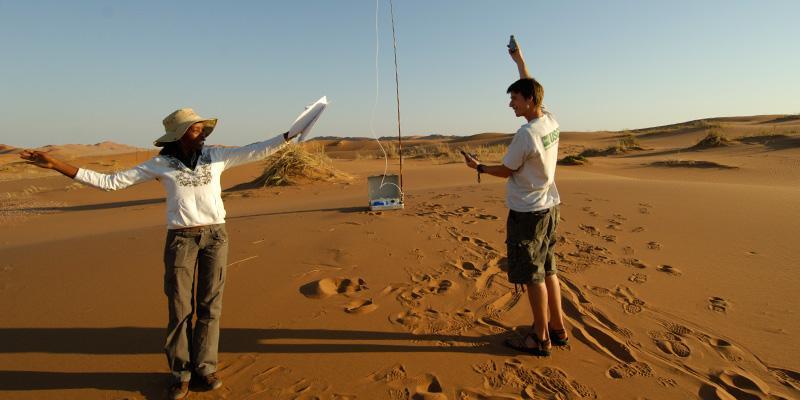
The Gobabeb Research Centre forms a joint venture with the Desert Research Foundation Namibia (DRFN) and the Ministry for Environment and Tourism. The main aim of the Gobabeb Training & Research Center is the research about arid ecosystems and their diversity, i.e. desertification, water catchment and adaptation of the fauna to the desert.
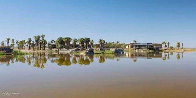
Gross Barmen is a hot spring and a popular destination. It is located 100 km from Windhoek and 24 km east of Okahandja and is a state-owned recreation area called Gross Barmen Hot Springs Resort.
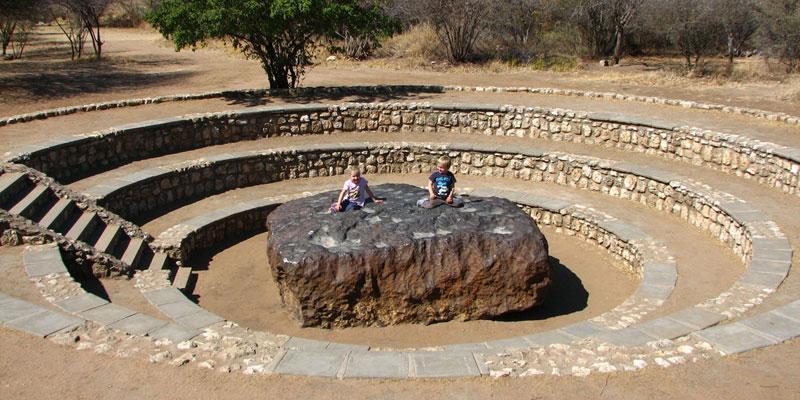
The experts all agree that the Hoba Meteorite is the biggest meteor that has been found on earth until today. The meteorite came down about 20 km west of Grootfontein about 80,000 years ago and still remains at the same place, which is not surprising, considering the weight of 50 tons.
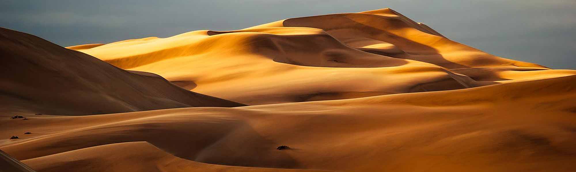
The Kalahari Semi-Desert forms the largest coherent sand plain worldwide. The Kalahari is part or a huge sand basin, the Kalahari Basin, that stretches from the Orange River up to Angola, in the west well into Namibia and in the east into Zimbabwe.
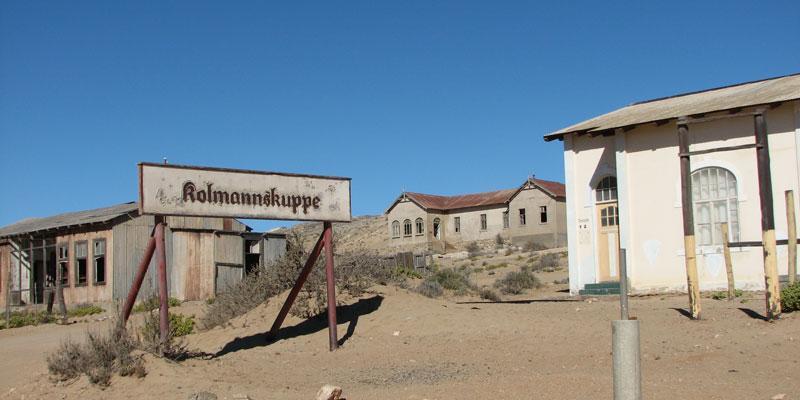
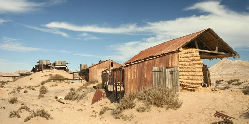
After becoming one of the richest towns in Africa during a diamond boom in 1910, Kolmanskop was left by all inhabtants in the following decades. Kolmanskop became a ghost town in the desert.
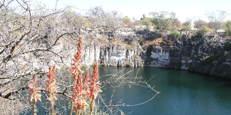
When travelling on the B1 from Tsumeb towards the Etosha national Park a highlight not to be missed can be found just a few kilometres outside Tsumeb on the left hand side of the road: Lake Otjikoto.
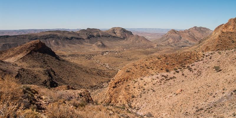
Both its formation and its mysterious 80 km shift south, as well as its historic value as habitat for the San thousands of years ago and as refuge and hiding place during the war of the 19th and 20th century render the Naukluft Mountains one of the most interesting places in Namibia.
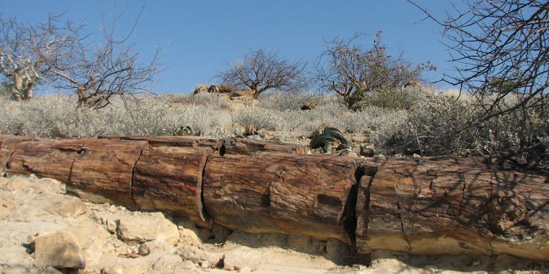
The Petrified Forest is a national monument, proclaimed on 1st March 1950, after being discovered by two farmers in the 1940s. The Petrified Forest is situated about 50 km west of Khorixas.
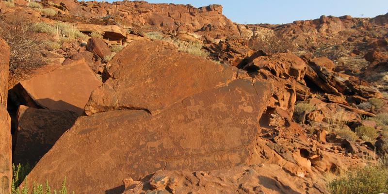
The numerous rock paintings in the Erongo Mountains proof that thousands of years ago the ancestors of today’s San have lived in the area. Especially during the dry winter months the Erongo Mountains offer a reliable water supply, thanks to impermeable granite pans, which are filled during the rainy season. Consequently the area has always had a rich wildlife – another reason for the Bushmen to inhabit the area! In the rocky Erongo the San lived mainly in caves or crevices.
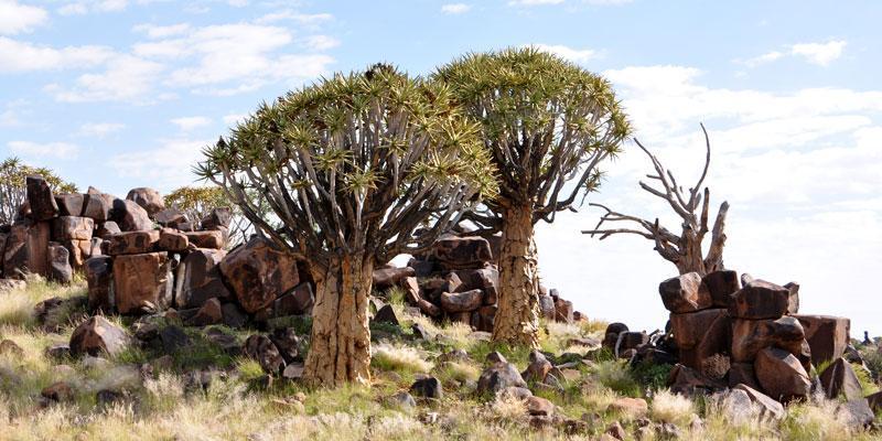
Travellers to the south of Namibia will find a fascinating point of interest near the town of Keetmanshoop: A large Quivertree Forest with thousands of quiver trees, close by a piece of land where a lot of Mesosaurus fossiles have been found and additionally a picturesque dolerite rock field.
The Restricted Diamond Area is also called the Sperrgebiet National Park (proclaimed in 2008) and stretches from the southern border of the Namib Naukluft Park to the Orange River, the border of Namibia and South Africa.
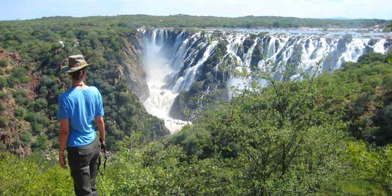
The Ruacana Falls have their origin, like the Epupa Falls in the Kunene River, the border River between Namibia and Angola. Close to the village Ruacana the Kunene, coming from Angola makes a sharp bend to the west to form the border between Namibia and Angola until it flows into Atlantic Ocean at the Skeleton Coast.
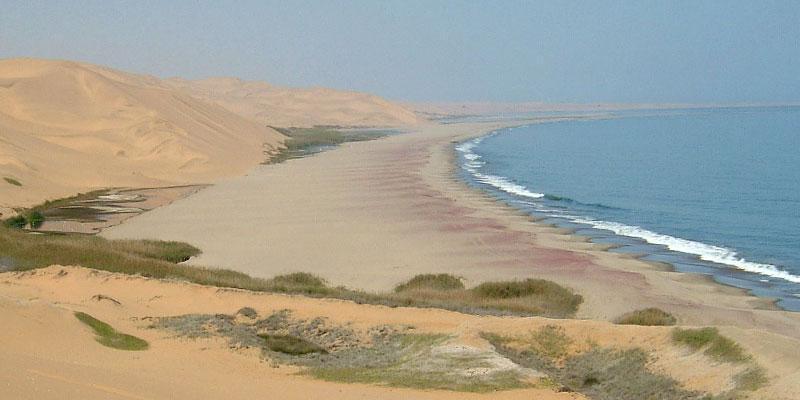
42 km south of Walvis Bay Sandwich Harbour is situated. The name Sandwich Harbour refers to the former harbour as well as the lagoon. Sandwich harbour is only accessible by 4x4. Guided tours from Walvis Bay are offered.
At Sesriem a visit to the nearby Sesriem Canyon is recommendable. The Sesriem Canyon is about 1 km long and 30 metres deep, carved into the rock by the Tsauchab River, which ends its course in the Sossusvlei.
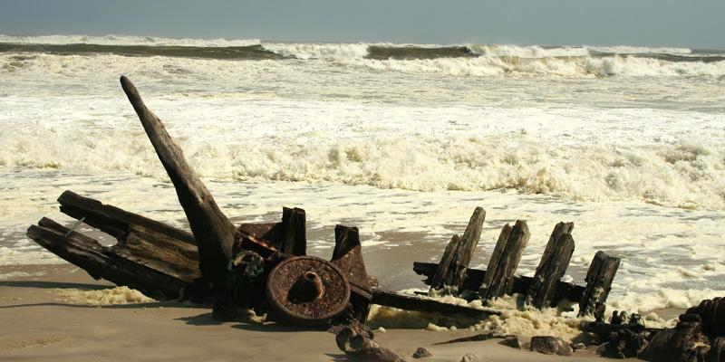
The so called Skeleton Coast is a 40 km wide and 500 km long coastal stretch in Namibia, a hostile but fascinating area. Here the cold and unpredictable Benguela Current of the Atlantic Ocean clashes with the dune and desert landscape of north-western Namibia.
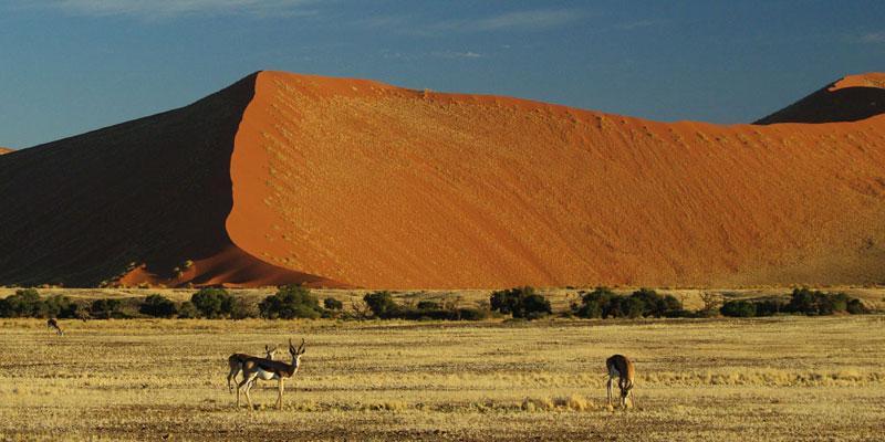
In the middle of the Namib Desert, in the Namib Naukluft Park two of Namibia’s scenic highlights can be found: the Sossusvlei and Dead Vlei
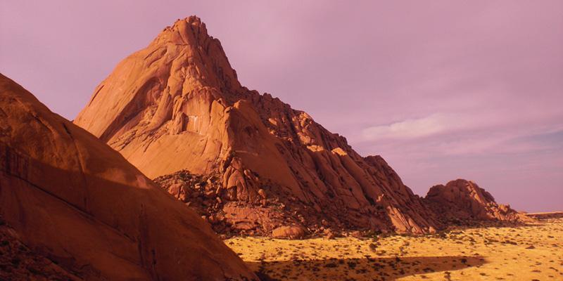
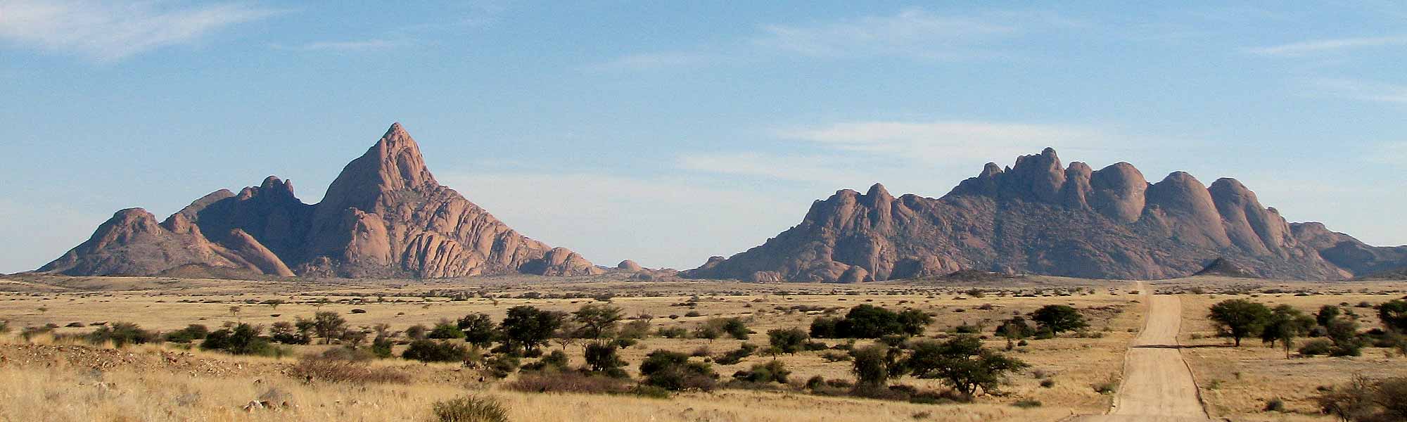
The Spitzkoppe is one of the most photographed mountain motifs of Namibia. This inselberg surmounts its surrounding by 700 metres with an overall height of 1728 m above sea level. Due to its distinctive form, which can be spotted from a great distance the Spitzkoppe is often called the “Matterhorn” of Namibia.
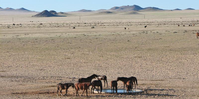
An attraction in the southern part of the Namib are the Feral Horses of Garub. These horses have successfully bypassed their role as working or breeding horses. They are independent of humans (more or less) and they fascinate us with their adapted live in a very inhospitable area and infinite freedom.
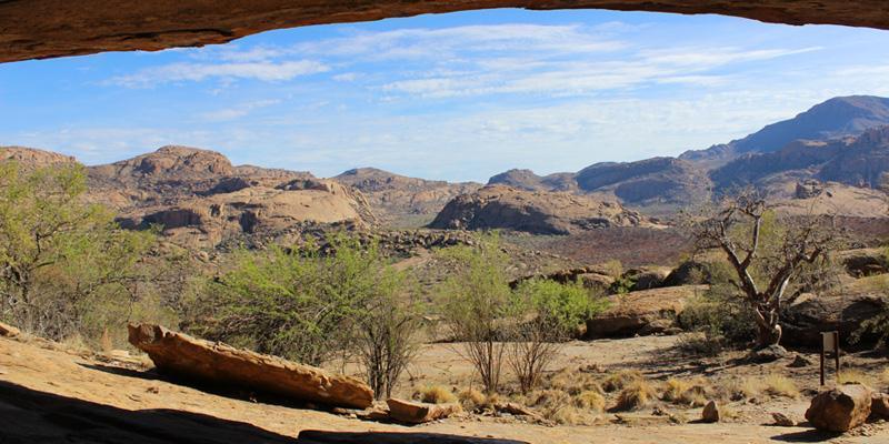
Twyfelfontein, which means as much as „doubtful fountain“ or „Fountain of Doubt“ is the name of a valley in the Damara highland about 70 km west of Khorixas. The valley was inhabited by the Damara, who call the valley Uri-Ais (jumping fountain) in their language.
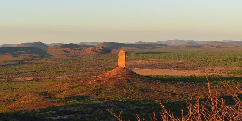
As if someone’s huge rock finger would protrude vertically into the air – this is how the Vingerklip stands, like a monument 70km west of the little town Outjo. Situated halfway be-tween Outjo and Khorixas, the Vingerklip is one of Namibia’s most famous and remarkable rock formations attracting substantial numbers of tourists.
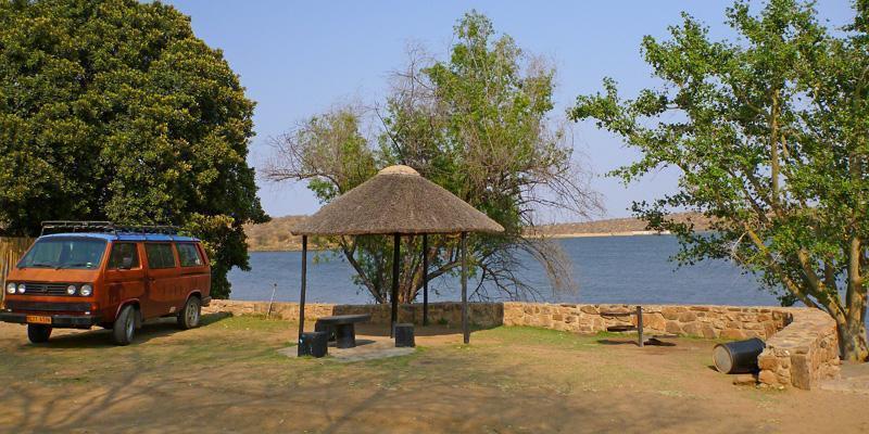
The Von Bach Dam is located about 60 kilometres north of Windhoek, the Namibian capital and 5 kilometres southeast of the town Okahandja. It has a capacity of about 49 million m³ and is the main water supply for Windhoek.
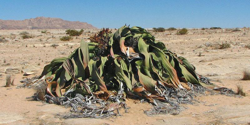
The Welwitschia Mirabilis is a plant which is endemic to the Namib desert in Namibia and Southern Angola. Named after Friedrich Welwitsch who "discovered" the plant in 1859, some of the specimen are estimated to be between 1000 and 1500 years old.
Namibia holiday planner & online booking system